Photos of the Canadian Rockies
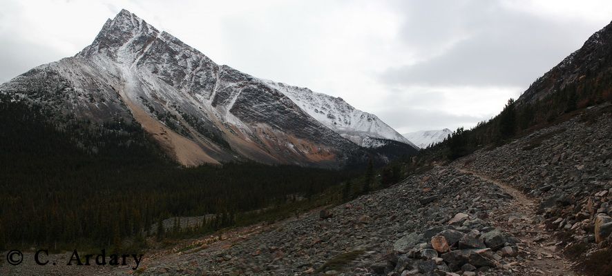
 This
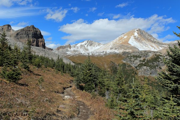
is the view back on the Portal Creek trail to the Tonquin
Valley. Marmot Mt. is the peak. This
is the view back on the Portal Creek trail to the Tonquin
Valley. Marmot Mt. is the peak. |
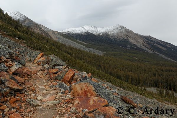
 This
is Aquila mt and the Portal Creek trail looking towards the
Tonquin Valley. Near the town of Jasper, Alberta. This
is Aquila mt and the Portal Creek trail looking towards the
Tonquin Valley. Near the town of Jasper, Alberta. |
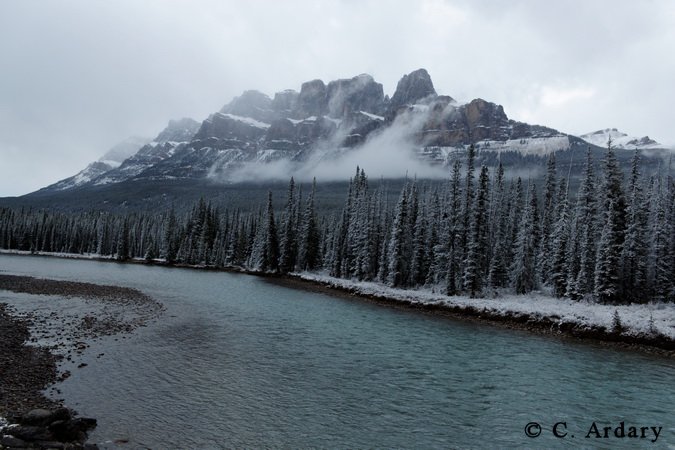 Castle
Mt. from a bridge across the Bow River during a light snow in
October. This is near Castle Junction about 20 miles south
of Lake Louise and 20 miles north of Banff. Castle
Mt. from a bridge across the Bow River during a light snow in
October. This is near Castle Junction about 20 miles south
of Lake Louise and 20 miles north of Banff. |
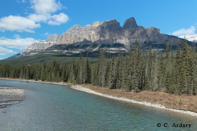 Castle
Mt. from the same location as the photo on the left. Taken
two days later. What a difference. I enjoyed both
days. Castle
Mt. from the same location as the photo on the left. Taken
two days later. What a difference. I enjoyed both
days. |
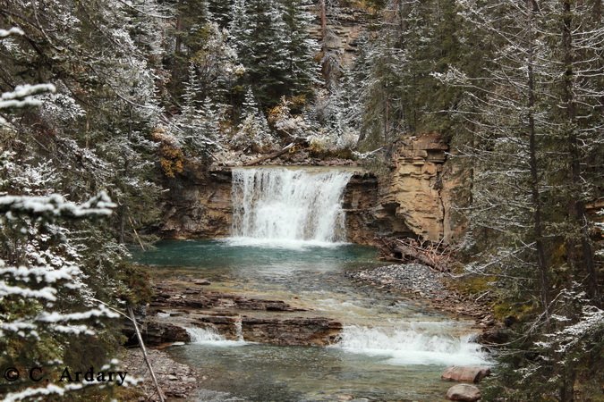 Johnston
Creek after a snow in October. This is about four miles
south of Castle Mt. Johnston
Creek after a snow in October. This is about four miles
south of Castle Mt. |
 Follow
Johnston Creek (left photo) past the waterfalls, up and over a
pass, then descend into this valley and you come to the Ink Pots
where you can find minerals to make dye as the Indians did.
There are trails to continue up the valley. Follow
Johnston Creek (left photo) past the waterfalls, up and over a
pass, then descend into this valley and you come to the Ink Pots
where you can find minerals to make dye as the Indians did.
There are trails to continue up the valley. |
 Castle
Mt and the Bow River. The photo to the right was taken in
the valley to the right of Castle Mt on a clear, sunny, fall
day. Castle
Mt and the Bow River. The photo to the right was taken in
the valley to the right of Castle Mt on a clear, sunny, fall
day. |
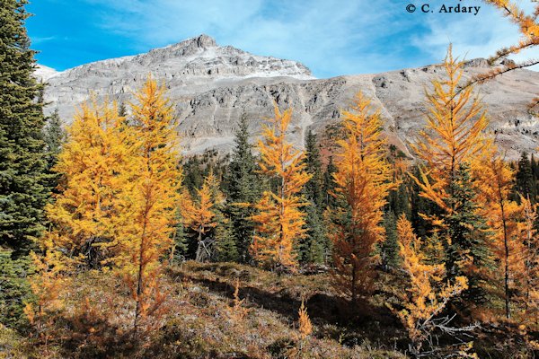 Fall
color larch on the trail to Rockbound Lake. The trail
leaves Castle Junction and climbs up behind Castle Mt. The
distance to here is about 3 miles. Castle Junction is
between Banff and Lake Louise. Fall
color larch on the trail to Rockbound Lake. The trail
leaves Castle Junction and climbs up behind Castle Mt. The
distance to here is about 3 miles. Castle Junction is
between Banff and Lake Louise. |
 This
is the trail to Lake Helen and Dolomite Pass. The lake is
just below the peak on the right, Cirque Peak, and the pass is
on the right of the peak. This
is the trail to Lake Helen and Dolomite Pass. The lake is
just below the peak on the right, Cirque Peak, and the pass is
on the right of the peak. |
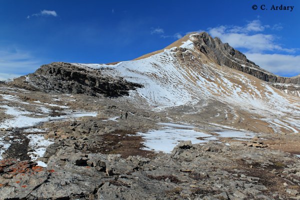 Cirque
Peak from Dolomite Pass (8200 feet). Next year I want to
finish the trip to Cirque Peak (9500 feet) Cirque
Peak from Dolomite Pass (8200 feet). Next year I want to
finish the trip to Cirque Peak (9500 feet) |
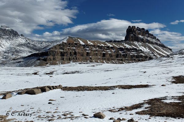 Dolomite
Peaks from Dolomite Pass. Dolomite
Peaks from Dolomite Pass. |
 Mt
Hector from the trail to Lake Helen and Dolomite Pass in
October. Mt
Hector from the trail to Lake Helen and Dolomite Pass in
October. |
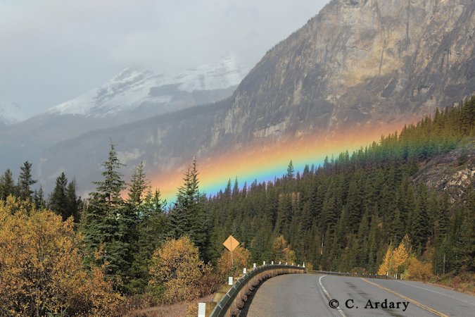 Rainbow
along the Icefields Parkway in Banff N.P. I drove through
the rainbow in about five minutes. Rainbow
along the Icefields Parkway in Banff N.P. I drove through
the rainbow in about five minutes. |
|
Waterfowl Lake and Mt Cephren This
was taken after an early season snowfall that left a dusting of
snow on the mountains. This
was taken after an early season snowfall that left a dusting of
snow on the mountains. |
Peyto Lake This
is a famous view in Banff National Park. The National Park
Service has asked to use this photo in a slide presentation on
World Heritage Sites. This
is a famous view in Banff National Park. The National Park
Service has asked to use this photo in a slide presentation on
World Heritage Sites. |
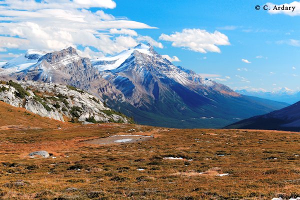
Cirrus Mt - summer view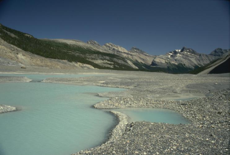 This
photo was taken during summer on a hike to the Saskatchewan
glacier which is behind the photographer. This
photo was taken during summer on a hike to the Saskatchewan
glacier which is behind the photographer. |
Cirrus Mt - winter view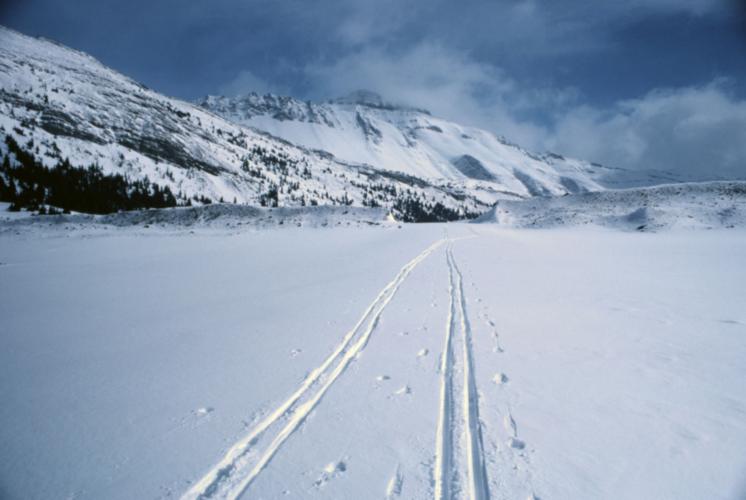 This
was taken on a cross country ski trip to the Saskatchewan
glacier in March. This
was taken on a cross country ski trip to the Saskatchewan
glacier in March. |
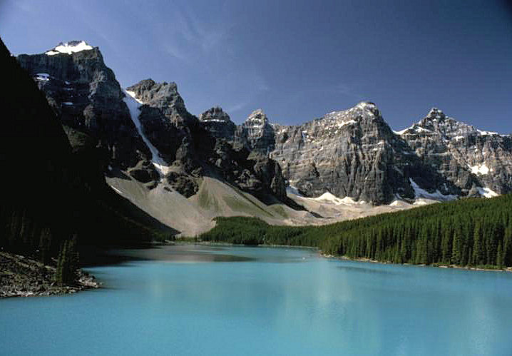 Morraine Lake, Banff National Park Morraine Lake, Banff National ParkOne of the classic photos to take in the Canadian Rocky Mountain Parks. |
 Mt
Sir Donald Peak in Revelstoke N.P. This was taken on the
Great Glacier Trail. It is about 2.5 miles and 1000 feet up to
get here. Mt
Sir Donald Peak in Revelstoke N.P. This was taken on the
Great Glacier Trail. It is about 2.5 miles and 1000 feet up to
get here. |
This site was last updated 05-Feb-2015